What Is a Bearing? A Simple Guide to Navigation Bearings
⚠️ SAFETY FIRST
A compass bearing is a useful navigation tool, but a bearing on its own doesn’t tell you exactly where you are.
When navigating outdoors, use a suitable map and compass together, consider the terrain and weather, and regularly check that your route still makes sense.
Don’t deliberately practise navigation by getting lost. Start in a familiar, safe area and build your skills gradually.
What Is a Bearing?
A bearing is a direction expressed as an angle from north.
In outdoor navigation, bearings are normally measured clockwise from north, using numbers from:
000° to 360°
For example:
- 000° = North
- 090° = East
- 180° = South
- 270° = West
So if someone tells you:
“Walk on a bearing of 090°.”
they are telling you to travel east.
💡 EXPLAIN IT SIMPLY
Think of a bearing as a number that tells you which direction to travel.
Instead of saying:
“Go roughly that way.”
you can say:
“Go on a bearing of 135°.”
That gives you a much more precise direction.
Why Use Bearings?
Directions such as:
- Left
- Right
- That way
- Towards the hill
aren’t particularly precise.
A bearing gives you a standard way of describing direction.
For example:
“Walk south-east.”
is useful.
But:
“Walk on a bearing of 135°.”
is more precise.
This is particularly useful when:
- Hiking
- Orienteering
- Camping
- Navigating unfamiliar areas
- Planning routes
- Working with a map
- Taking part in Scouting activities
The 360-Degree Compass
To understand bearings, you first need to understand the basic compass directions.
Imagine a circle divided into 360 degrees.
At the top is:
North — 000°
Moving clockwise:
East — 090°
South — 180°
West — 270°
Then back around to:
North — 360°
Because 000° and 360° represent the same direction, bearings are normally written using three digits.
So you would write:
005°
rather than:
5°
and:
090°
rather than:
90°
This makes navigation instructions clearer.
Bearing Cheat Sheet
|
Direction |
Bearing |
|---|---|
|
North |
000° / 360° |
|
North-east |
045° |
|
East |
090° |
|
South-east |
135° |
|
South |
180° |
|
South-west |
180° |
|
West |
270° |
|
North-west |
315° |
These are the cardinal and intercardinal directions.
There are, of course, 360 possible whole-degree bearings.
Is a Bearing the Same as a Direction?
They’re closely related, but not exactly the same.
Direction is the general concept.
Bearing gives that direction a numerical value.
For example:
Direction: South-east
Bearing: 135°
This makes bearings particularly useful when you need to communicate a direction accurately.
What Is a Compass Bearing?
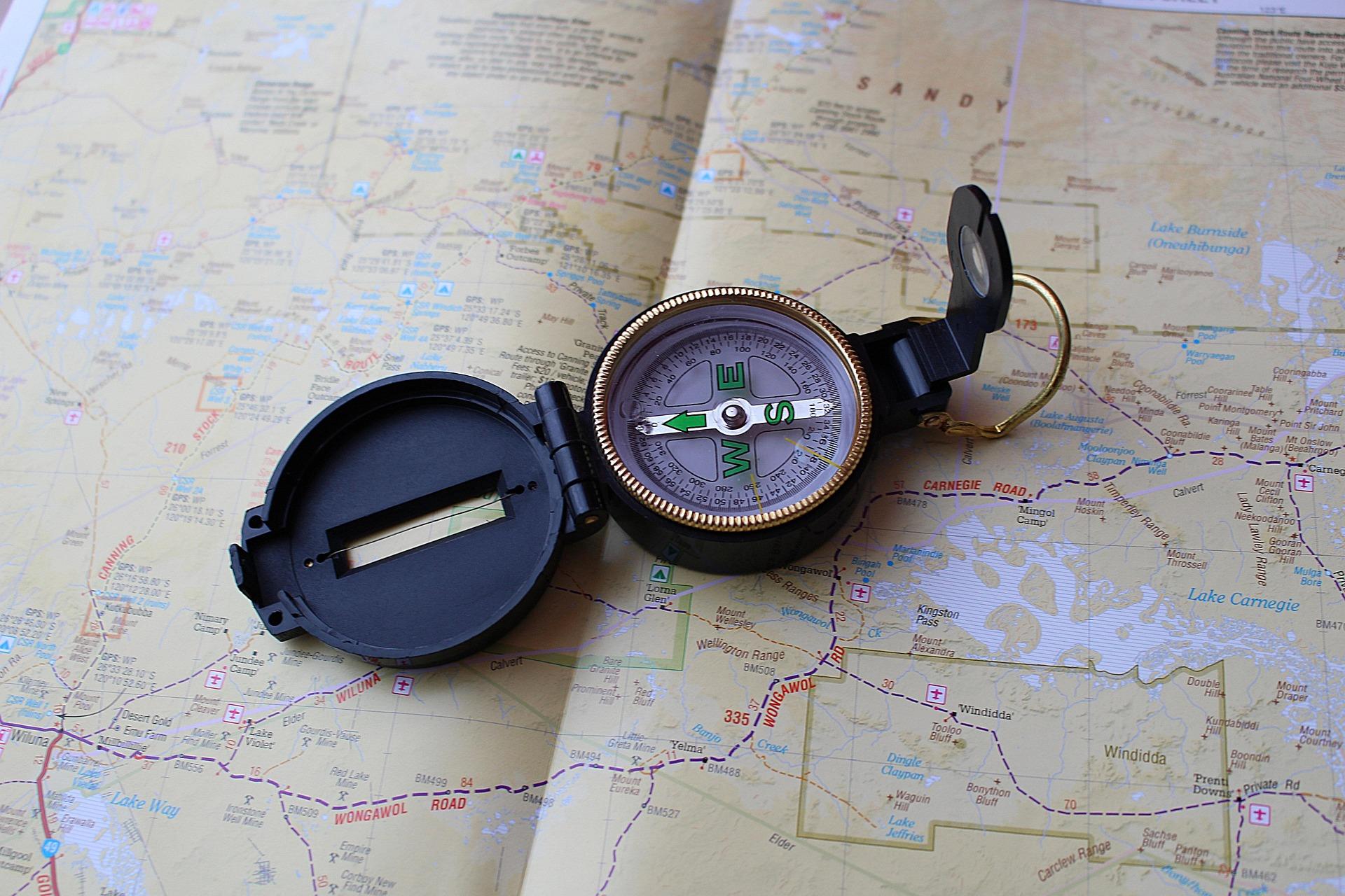
A compass bearing is a bearing taken or followed using a compass.
For example, you might use a compass to determine:
“This hill is on a bearing of 070°.”
You could then record that bearing and use it as part of your navigation plan.
A compass can also be used to follow a bearing.
How Do You Take a Bearing?
There are several ways to take a bearing, depending on what you’re trying to achieve.
One common method is to take a bearing from your current position to a visible object.
For example, imagine you’re standing at the edge of a field and can see a distinctive tree.
You want to know the direction from you to the tree.
You can:
You might find that the tree is:
065°
You now know that the tree lies approximately 65 degrees clockwise from north.
🧭 REMEMBER
A bearing is measured clockwise from north.
North → 000°
East → 090°
South → 180°
West → 270°
How Do You Follow a Bearing?
Taking a bearing and following a bearing are slightly different skills.
Suppose you’ve been given:
120°
You need to travel in that direction.
A simple approach is:
- Set your compass to 120°.
- Hold it level.
- Turn your body until the compass indicates the correct direction.
- Look ahead.
- Choose a suitable landmark in that direction.
- Walk towards it.
- Repeat the process.
The landmark is useful because it allows you to move while keeping the same general direction.
Don’t Walk While Staring at Your Compass
This is an important beginner lesson.
You shouldn’t simply walk along while staring down at your compass.
That creates several problems.
You might:
- Walk into an obstacle
- Miss a path
- Trip
- Fail to notice a hazard
- Lose awareness of your surroundings
Instead:
Take a bearing → identify a landmark → put the compass away → walk to the landmark → check again.
This is both safer and more practical.
What Is a Back Bearing?
A back bearing is the direction back towards where you started.
It’s sometimes called the reverse bearing.
For example:
If your original bearing is:
060°
the reverse bearing is:
240°
If your original bearing is:
150°
the reverse bearing is:
330°
The general rule is:
If the bearing is less than 180°:
Add 180°
If the bearing is greater than or equal to 180°:
Subtract 180°
So:
070° → 250°
220° → 040°
This can be useful when checking your route or working out the direction back to a previous point.
Why Is a Back Bearing Useful?
Imagine you’re walking from one point to another.
You record:
080°
Later, you need to return.
Your approximate reverse bearing is:
260°
This gives you another way of checking your direction.
Back bearings can also be useful when:
- Checking navigation instructions
- Retracing a route
- Taking bearings between landmarks
- Working with a map
What Is a Grid Bearing?
This is where navigation can become slightly more complicated.
A grid bearing is a bearing measured relative to grid north on a map.
Maps such as Ordnance Survey maps use a grid system.
Grid north is the direction of the vertical grid lines on the map.
This isn’t necessarily exactly the same as:
- Magnetic north
- True north
Understanding the difference becomes important when taking accurate compass bearings from a map.
For beginners, the important thing to remember is:
A map and compass need to be used together correctly.
Don’t assume that every form of north means exactly the same thing.
What Is Magnetic North?
Magnetic north is the direction towards the Earth’s magnetic north pole.
A magnetic compass points towards magnetic north, rather than directly towards geographic or true north.
The difference between magnetic north and other forms of north is known as magnetic declination or magnetic variation.
This varies depending on where you are and changes over time.
For casual navigation in some situations, the difference may be relatively small.
For accurate map-and-compass navigation, however, you need to understand which north your map and compass are using and whether an adjustment is required.
🧭 BEGINNER TIP
Don’t worry if true north, grid north and magnetic north sound confusing at first.
Learn basic bearings first.
Once you’re comfortable with 000°, 090°, 180° and 270°, you can move on to understanding how different north references affect map-and-compass navigation.
What Is a Bearing From a Map?
You can also take a bearing from a map.
For example, you might want to work out the direction from:
Point A → Point B
You can use a suitable compass and map to determine the bearing between the two points.
That bearing can then be used when you’re actually outdoors.
This is one of the most useful applications of bearings.
Instead of simply looking at a map and thinking:
“I’ll head towards that hill.”
you can establish a specific direction to travel.
Bearings and Landmarks
Bearings become much easier to use when combined with visible landmarks.
Suppose you’re navigating across open ground.
Your bearing is:
110°
Rather than trying to walk hundreds of metres while continuously checking your compass, identify something ahead of you that’s roughly in that direction.
It could be:
- A tree
- A fence post
- A building
- A hill
- A rock
- A bend in a path
Walk to that feature.
Then take another bearing.
This is often called using aiming points.
What If There Are Obstacles?
Real terrain rarely looks like a perfectly straight line.
Your bearing might point directly through:
- A lake
- A fence
- A cliff
- Dense vegetation
- A building
- Private land
Don’t blindly follow the compass.
The terrain comes first.
You may need to safely go around an obstacle and then re-establish your original direction.
This is one reason why navigation isn’t simply:
“Follow the number.”
You also need to understand the environment.
A Bearing Doesn’t Tell You Everything
This is an important concept.
Suppose someone tells you:
“Walk on a bearing of 090°.”
You know the direction.
But you don’t know:
- How far to walk
- What terrain you’ll encounter
- Whether there is a path
- Whether you can safely cross the area
- Where exactly you’ll end up
A bearing gives you direction, not a complete route.
That’s why good navigation combines:
Map + Compass + Terrain + Observation
Bearings and Distance
Bearings become much more useful when combined with distance.
For example:
“Travel 120° for approximately 500 metres.”
Now you have:
Direction + Distance
This is much more informative than simply being given a direction.
In practical navigation, distance might be estimated using:
- Timing
- Pacing
- Map measurements
- Terrain features
- GPS
Pacing and Bearings
Some navigators use pacing to estimate distance.
For example, you might establish how many double steps you normally take to cover a known distance.
Then, when following a bearing, you can use your pace count to estimate how far you’ve travelled.
This can be useful when there aren’t obvious landmarks.
However, pacing isn’t perfectly accurate.
Your stride can change because of:
- Hills
- Ground conditions
- Fatigue
- Backpack weight
- Weather
- Vegetation
So treat pacing as an estimate, not an exact measurement.
Bearings in Orienteering
Bearings are particularly useful in orienteering.
Orienteering involves navigating between checkpoints using a map and often a compass.
A participant might need to:
- Identify their location
- Find a control point
- Take a bearing
- Estimate distance
- Navigate around obstacles
- Confirm their position
This makes orienteering a great way to practise navigation skills in a structured environment.
Bearings in Scouting
Bearings are also an important traditional Scout navigation skill.
Scouts and Explorers may encounter bearings when learning:
- Map reading
- Compass use
- Route planning
- Hiking
- Orienteering
- Expeditions
They’re a good example of progression from simply knowing the four compass points to understanding precise navigation.
Bearings and Natural Navigation
Natural navigation might tell you:
“That ridge appears to be roughly east of us.”
A compass bearing lets you be much more precise:
“The ridge is approximately 090° from our current position.”
The two skills complement each other.
Natural navigation helps you understand the environment.
A compass helps you establish direction more precisely.
Common Bearing Mistakes
Reading the wrong end of the compass
Make sure you’re reading the bearing correctly.
A compass has several markings and numbers, so it’s easy for beginners to accidentally read the wrong scale.
Forgetting that bearings are clockwise from north
Bearings aren’t measured from your current direction.
They’re measured from north.
Writing 90 instead of 090
Both mean the same angle, but three-digit bearings are the standard format used in navigation.
Walking while staring at the compass
Look ahead and use landmarks.
Assuming a bearing is a route
A bearing gives you direction.
It doesn’t tell you whether the terrain is safe or accessible.
Not checking your position
Don’t blindly follow a bearing for a long distance without checking where you are.
Bearing Quick Reference
Keep this simple table handy:
|
Bearing |
Direction |
|---|---|
|
000° |
North |
|
045° |
North-east |
|
090° |
East |
|
135° |
South-east |
|
180° |
South |
|
225° |
South-west |
|
270° |
West |
|
315° |
North-west |
|
360° |
North |
Remember that there are 360 degrees in a full circle, so every direction can be represented by a bearing.
A Simple Bearing Exercise
You can practise bearings without going anywhere remote.
Find a safe, open area.
Choose several visible landmarks.
For example:
Tree A
Building B
Hill C
Take a compass bearing to each one.
You might record:
- Tree A — 045°
- Building B — 120°
- Hill C — 280°
Then check those directions against a map.
This helps you connect:
Compass → Direction → Landscape → Map
That’s the foundation of practical navigation.
Beginner Bearing Checklist
Final Thoughts
So, what is a bearing?
At its simplest:
A bearing is a direction expressed as an angle measured clockwise from north.
Once you understand that, the system becomes much easier.
000° → North
090° → East
180° → South
270° → West
From there, you can start using bearings to:
- Take directions
- Follow routes
- Work with maps
- Navigate between landmarks
- Check your position
- Explore unfamiliar areas
But remember that a bearing is only one part of navigation.
The best navigation combines:
Map.
Compass.
Terrain.
Observation.
Common sense.
And most importantly, don’t let a number on a compass override what’s happening around you.
🧭 THE SIMPLE DEFINITION
A bearing is simply a precise way of saying which direction you need to travel.
Once you understand bearings, a compass becomes much more useful.
🔗 Explore More
- What Is Natural Navigation? — learn how nature can provide navigation clues.
- Getting Lost — what to do if you lose your route or become unsure of your location.
- Survival Priorities — understand what matters most when something goes wrong.
- Basic Knots — another useful foundation for outdoor skills.
- Emergency Shelters — prepare for situations where a planned journey doesn’t go to plan.
🔒Ready to test your survival skills?
Join Survival Guides UK for free, complete challenges, earn badges and increase your Survival Level.
JOIN FREE →
CRAIG BURR
FOUNDER · SURVIVAL GUIDES UK
I'm Craig, the person behind Survival Guides UK. I created SGUK because I wanted somewhere people could learn real outdoor skills in a practical, straightforward way — from lighting a fire and tying knots to navigation, campcraft and everything in between.
You can read more about the story behind SGUK here as well as our approach here.