How to Orientate a Map
Being able to orientate a map is one of those navigation skills that makes everything else much easier. Instead of trying to mentally turn the landscape around to match the map, you turn the map so that it represents the ground in front of you.
Once a map is orientated, features on the paper should line up with the features you can see around you. A hill, road, stream or building shown on the map should be in the same direction as the real feature.
You can orientate a map using a compass, but there are also situations where you can do it using obvious landmarks that you can physically see.
What Does It Mean to Orientate a Map?
To orientate a map simply means turning it so that the directions and features on the map correspond with the real world around you.
Most maps are printed with north at the top. If you simply hold the map upright without checking which way you’re facing, the map may not match the landscape.
For example, if a road runs from east to west in front of you but the road on your map appears to run from north to south, your map isn’t orientated correctly.
Turn the map until the road on the map runs in the same direction as the real road.
This makes the map much easier to read because you can quickly look at the map and the landscape at the same time to ensure that you are still heading in the correct direction.
Orientating a Map With a Compass
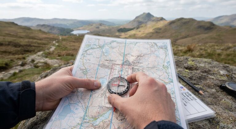
Using a compass is the most reliable way to orientate a map.
Place the map somewhere flat if possible. Put your compass on the map and make sure that the direction-of-travel arrow points towards the top of the map.
The top of the map represents north.
Now turn both the map and compass together until the magnetic needle points towards north on the compass.
The map is now orientated to magnetic north.
However, there is an important detail to understand when using a map and compass: grid north and magnetic north are not exactly the same direction.
Maps show grid north using the grid lines, while a magnetic compass points towards magnetic north. The difference between them is called magnetic variation or magnetic declination.
For normal outdoor navigation, you need to know whether your map requires you to account for this difference and follow the instructions printed on the map.
A Simple Way to Remember It
When you’re learning, don’t overcomplicate it because it really is a basic process.
Think:
Map north → Compass north → Turn until they agree.
Keep the map and compass together and rotate them until the compass indicates north in the same direction as north on the map.
Once the map is orientated, avoid turning the map unnecessarily while you’re trying to navigate.
Orientate a Map Using Landmarks
You don’t always need a compass.
If you’re somewhere with several obvious features, you can orientate the map by matching what you can see with what is printed on the map.
Look for something distinctive such as:
- a road
- a railway line
- a river
- a prominent hill
- a church tower
- a mast
- a large building
- a distinctive bend in a path
Find the same feature on your map.
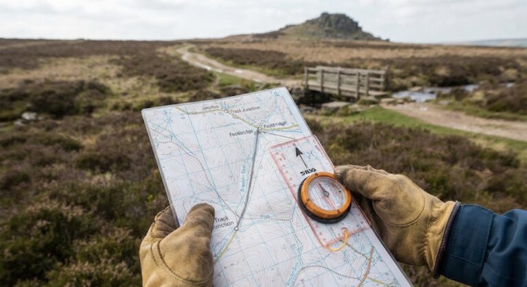
Then turn the map until the feature on the map points in the same direction as the real feature.
You can then check it against another feature.
For example, if you can see a church tower in front of you and a hill to your right, find both on the map. Turn the map until both features appear in roughly the same positions as they do in the landscape.
If several features line up, you can be reasonably confident that your map is orientated correctly.
Use Linear Features to Make It Easier
Long, straight or gently curving features are particularly useful.
A road, railway, river or long path gives you a clear line to compare with the map.
Suppose you’re standing beside a road that runs roughly from left to right.
Find that road on the map and turn the map until the mapped road runs from left to right in the same way as the real road.
You can then use other nearby features to confirm the orientation.
This is often easier than trying to work out north immediately.
Don’t Forget That the Map Can Be Upside Down
There is nothing wrong with turning a map around while you’re orientating it.
Maps are normally printed with north at the top, but when you’re navigating, the useful thing is being able to match the map to the landscape.
Once you have orientated the map, the top of the map may not be pointing towards the top of your field of view. That’s perfectly normal.
The important thing is that the map matches the ground and what you see around you.
If you are working with other people, however, remember that they may naturally expect north to be at the top of the map. Before handing a map to someone else, it can be helpful to explain which way you have orientated it.
Check More Than One Feature
One matching feature isn’t always enough.
You might identify a hill correctly but accidentally choose the wrong hill on the map. You might also mistake one path for another.
After orientating your map using one feature, look for a second and preferably third feature that confirms your position.
For example, you might identify a road and a stream. If both appear where you expect them to be, your confidence in the map orientation increases.
This habit is particularly useful when the landscape contains several similar-looking hills, paths or fields.
Orientate Your Map Before You Start Walking
It’s worth orientating your map before setting off rather than waiting until you’re already confused.
Take a moment to look at the surrounding landscape.
Find your current position on the map, identify a few obvious features and turn the map until everything matches.
Then work out where you need to go.
You’ll find it much easier to follow a route when the map and landscape are already aligned.
Keep the Map Orientated as You Move
You don’t necessarily need to keep physically rotating the map every few seconds.
Instead, turn it when you need to compare the map with the landscape.
For example, if you’re following a path, you might orientate the map so that the path ahead on the map matches the path ahead of you.
As you move, check your position regularly and make small adjustments when necessary.
This prevents you from getting too far along a route before discovering that you’ve been following the wrong path all along.
What If the Landscape Doesn’t Match the Map?
Don’t immediately assume that the map is wrong.
Stop and check the basics.
Make sure you’re looking at the correct feature. Check your current position. Look for another landmark that can confirm where you are.
It is surprisingly easy to mistake one path, hill or field boundary for another when you’re unfamiliar with an area.
If the map and landscape still don’t agree, stop moving until you’ve worked out why.
Continuing in the hope that things will eventually make sense can turn a small navigation error into a much bigger one.
Safety When Using a Map Outdoors
Orientating a map is simple, but don’t let the map distract you from what’s actually happening around you.
If you’re standing near a road, steep slope, cliff edge, river or other hazard, move to a safe place before concentrating on navigation. Don’t try reading the map while you’re still moving.
In poor weather or low visibility, take extra care when checking your position and don’t rely on being able to recognise distant landmarks.
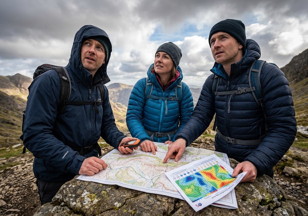
If you’re navigating with a group, make sure everyone knows when you’re stopping and changing direction.
A map is a navigation tool. It is not a substitute for paying attention to the terrain you’re actually walking through.
Practise Orientating a Map
You don’t need to go on a long walk to practise this skill.
Take a map of a familiar area and go somewhere where you can identify several features.
Try orientating the map without looking at a compass.
Find a road, building or hill and turn the map until it matches what you can see. Then check your work using a compass.
After you’ve done this a few times, try doing it in a less familiar area.
You’ll start to recognise how the shape of the landscape, paths and other features fit together. You will soon realise that orientating a map really isn’t difficult.
Make Map Orientation Part of Your Navigation Routine
Orientating a map is a small skill, but it makes map reading much more intuitive.
Instead of looking down at a map and trying to imagine which way everything is in the real world, you can make the map match the landscape and read the two together.
Use a compass when you need an accurate orientation, or use clear landmarks when the landscape gives you enough information.
Then keep checking your position as you travel.
The more often you practise orientating a map, the quicker it becomes. Eventually, turning the map to match the ground will become a natural part of your navigation rather than something you have to stop and think about.
🔒Ready to test your survival skills?
Join Survival Guides UK for free, complete challenges, earn badges and increase your Survival Level.
JOIN FREE →
CRAIG BURR
FOUNDER · SURVIVAL GUIDES UK
I'm Craig, the person behind Survival Guides UK. I created SGUK because I wanted somewhere people could learn real outdoor skills in a practical, straightforward way — from lighting a fire and tying knots to navigation, campcraft and everything in between.
You can read more about the story behind SGUK here as well as our approach here.