Explorers Navigation Activities: Fun Ways to Learn Navigation
Navigation is one of the most valuable outdoor skills an Explorer can develop.
At Explorer level, navigation can move beyond simple map-reading exercises.
Young people can start making their own route decisions, interpreting more complicated terrain, using different navigation methods and solving realistic problems.
The aim isn’t simply to teach Explorers how to follow a line on a map.
It’s to help them understand where they are, where they want to go, how to get there and how to recognise when something isn’t going according to plan.
⚠️ SAFETY FIRST
Navigation activities should always take place in a suitable area that has been checked and risk assessed beforehand.
Explorers should never be deliberately made to become lost. Make sure leaders know the planned route and boundaries and have appropriate emergency arrangements in place.
Take particular care around roads, railways, water, cliffs, steep ground, dense vegetation and changing weather. Night navigation and remote navigation require additional planning, equipment and supervision.
Follow current Scouts safety, safeguarding and activity guidance.
1. Navigation Treasure Hunt
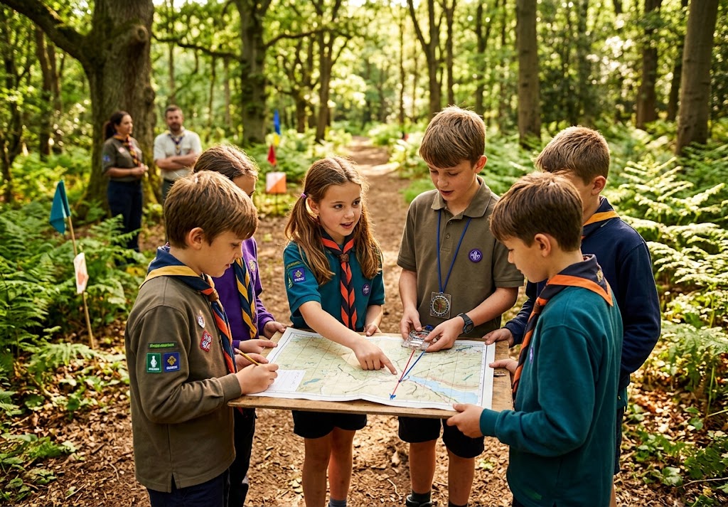
Give each Patrol a map containing a series of checkpoints.
At each checkpoint, Explorers find a clue or complete a navigation task before continuing.
Make the route progressively harder.
Early checkpoints might involve map symbols and grid references.
Later ones could require compass bearings, contour interpretation or route choices.
2. Grid Reference Challenge
Give Explorers a selection of grid references and ask them to locate each one.
Then reverse the challenge.
Point out a feature on the map and ask them to provide its grid reference.
Once they’re confident, introduce six-figure grid references and encourage accurate map work.
3. Map Symbol Challenge
Give Explorers a list of map symbols to identify.
Then ask them to locate examples on a real map.
Make it competitive by giving Patrols a time limit, but encourage accuracy over speed.
This is particularly useful before a hiking or expedition activity.
4. Contour Line Challenge
Give Explorers a map containing several different types of terrain.
Ask them to identify:
Hills
Valleys
Ridges
Steep slopes
Gentle slopes
Then compare their predictions with the actual landscape.
This helps Explorers understand that contour lines aren’t just something to memorise.
They describe the shape of the ground.
5. Choose the Best Route
Give Explorers several possible routes between two points.
Ask:
“Which route would you choose?”
There shouldn’t necessarily be one obvious answer.
A route might be shorter but steeper.
Another might be longer but use a clear path.
Another might avoid difficult terrain.
Discuss the reasons behind each decision.
This develops navigation judgement, not just map-reading ability.
6. Route Planning Challenge
Give each Patrol a starting point, destination and a list of conditions.
For example:
“Plan a route that avoids steep ground, crosses as few roads as possible and includes a suitable stopping point.”
Explorers must study the map and create their own route.
Then have them explain their decisions.
7. Orienteering Course
Set up an orienteering course appropriate to the group’s ability.
Explorers navigate between checkpoints using a map.
Once they are confident, introduce route-choice challenges where there are several possible ways to reach the next checkpoint.
Encourage Explorers to check their position regularly rather than simply rushing between markers.
8. Compass Bearing Challenge
Give Explorers a series of bearings to follow in a suitable open area.
Start with simple directions and gradually increase the accuracy required.
They can use the bearings to locate markers or clues.
Make sure the area has been carefully checked beforehand and that clear boundaries are established.
9. Bearing and Distance Course
Combine compass bearings with approximate distances.
Explorers navigate from one point to another and then use the next instruction.
This introduces the idea of dead reckoning in a simple, controlled environment.
The objective is accuracy and understanding rather than covering a large distance.
10. Navigation Relay
Create several navigation stations.
One might involve grid references.
Another could involve compass work.
Another could test map symbols.
Another might involve contour lines.
Another could require route planning.
Patrols rotate through the stations and collect points.
This gives Explorers repeated practice without requiring one long navigation exercise.
11. Navigation Memory Challenge
Give Explorers a map and a few minutes to study a route.
Take the map away.
Ask them questions about what they remember.
“Where was the stream?”
“Which direction did the route turn?”
“Where was the steepest section?”
“What feature was near the checkpoint?”
The activity encourages Explorers to develop a mental picture of the landscape.
12. Map and Landscape Challenge
Take Explorers somewhere with varied terrain.
Give them a map and ask them to identify features around them.
Which hill are they looking at?
Where is the valley?
Which direction is the path heading?
Where would the stream appear on the map?
This teaches Explorers to connect two-dimensional map information with the three-dimensional landscape.
13. Navigation Without a Compass
Ask Explorers to imagine that their compass has stopped working.
What information could they still use?
They might discuss:
Map features
Landmarks
Paths
Terrain
Sun position
Known locations
The activity isn’t about teaching unreliable shortcuts.
It’s about demonstrating that good navigation uses multiple sources of information.
14. GPS Navigation Challenge
Introduce GPS alongside traditional navigation.
Give Explorers predetermined coordinates or locations to find using suitable GPS equipment.
Then compare the GPS information with a paper map.
Ask:
“What would happen if the battery died?”
“What if the signal or device wasn’t available?”
The lesson is that technology can be useful, but navigation skills shouldn’t depend entirely on it.
15. What3words and Location Sharing
Introduce modern location systems such as what3words alongside GPS coordinates and traditional grid references.
Ask Explorers how they would communicate their location to someone else.
Discuss which method might be useful in different situations.
Emphasise that digital location systems should complement sensible navigation and emergency planning rather than replace them.
16. Night Navigation
Night navigation can provide a significant challenge for experienced Explorers.
Use a familiar or carefully assessed area first.
Explorers can practise route finding, map reading and direction finding with reduced visibility.
Use appropriate lighting and establish clear boundaries.
⚠️ NIGHT NAVIGATION SAFETY
Never use darkness to deliberately make Explorers become lost.
Keep leaders aware of everyone’s location, use a suitable route and have an agreed emergency procedure.
Consider weather, visibility, terrain, road crossings and access to help before starting.
17. Navigation in Poor Weather
Give Explorers a planned route and then introduce changing conditions.
For example:
“Visibility has reduced.”
“The wind has increased.”
“Heavy rain has made part of the route unsuitable.”
Ask what they would do.
Would they continue?
Change route?
Turn around?
Wait?
This teaches an important lesson:
A navigation plan is not a promise to continue regardless of conditions.
18. Navigation Decision Points
During a route, stop at selected locations and ask Explorers to make a decision.
“Where are we?”
“What evidence tells you that?”
“Where should we go next?”
“What could confirm our position?”
This encourages them to actively navigate rather than simply follow a leader.
19. Lead the Route
Give an Explorer responsibility for leading part of a familiar route.
They should explain the route, identify landmarks and keep track of the group’s progress.
Rotate the responsibility between Explorers.
An adult leader remains responsible for the overall activity and safety.
20. Navigation Error Challenge
Create a fictional situation where a Patrol has made a navigation mistake.
For example:
“You expected to reach a bridge, but you’ve been walking for much longer than planned and can’t see it.”
Ask Explorers what they should do.
The important answer is not simply “keep walking”.
They should consider stopping, checking their information, retracing their route if appropriate and communicating with their leader or support system according to the activity plan.
This teaches one of the most important navigation skills:
Recognising when you are unsure.
21. Relocation Challenge
Give Explorers a map and secretly move them to a different known location within a safe, supervised area.
Can they work out where they are?
They can examine visible features and compare them with the map.
Only use locations where the group can remain safely within the agreed boundaries.
22. Navigation and First Aid
Combine navigation with an emergency scenario.
For example:
“Someone has injured their ankle. Where are you, and how would you communicate your location?”
Explorers need to identify their position and explain how they would give useful location information.
This combines navigation with emergency planning.
23. Navigation and Expedition Planning
Give Explorers a proposed expedition route.
Ask them to assess it.
Where are the difficult sections?
Where could they stop?
Where are the escape routes?
Where are roads or water crossings?
What alternative routes exist?
This develops the planning skills needed for longer journeys.
24. Navigation Scavenger Hunt
Give Patrols a list of locations to find.
Instead of simply giving coordinates, provide clues.
For example:
“Find the point where the footpath meets the stream.”
Or:
“Locate the highest point on this section of the route.”
Explorers must interpret the map to work out where the clue refers to.
25. Create Your Own Navigation Course
Once Explorers are confident, give them responsibility for creating an activity for another Patrol.
They need to choose suitable checkpoints, prepare instructions and check that the route works.
They also need to think about safety and accessibility.
This transforms navigation from something they are learning into something they can teach.
Teach Navigation as Decision-Making
The most useful navigation question isn’t:
“What bearing should I take?”
It’s:
“What information do I have, and what does it tell me?”
Encourage Explorers to combine:
Map information
Compass direction
Terrain
Landmarks
Distance
Time
Weather
Other navigation technology
The more sources they can compare, the more confidently they can check their position.
Teach Explorers to Stop
One of the most important navigation skills is knowing when to stop moving.
If something doesn’t make sense, don’t simply continue and hope it becomes clearer.
Stop.
Think.
Check the map.
Look around.
Compare the landscape with your route.
Then decide what to do.
STOP — CHECK — DECIDE
This simple habit can prevent a small navigation error from becoming a much bigger problem.
Don’t Always Make It a Race
Navigation competitions can be exciting.
But speed isn’t the only measure of ability.
An Explorer who stops to confirm their position may demonstrate better navigation than someone who reaches the checkpoint first by taking unnecessary risks.
Reward:
Accuracy
Good decisions
Teamwork
Observation
Communication
Safety
Speed can come later.
Build Towards Expeditions
Navigation activities should gradually prepare Explorers for real journeys.
Start with simple map reading.
Move to compass work.
Introduce route planning.
Add terrain interpretation.
Then introduce realistic decisions involving weather, time and changing conditions.
Eventually, these skills can be combined during expeditions and longer outdoor adventures.
Let Explorers Lead
At Explorer level, young people should have opportunities to take greater responsibility for navigation.
A leader can provide the route and safety framework while allowing Explorers to make decisions within that framework.
Ask:
“Where are we?”
“How do you know?”
“What’s our next feature?”
“What could make us change the plan?”
These questions develop confident navigators far better than simply giving them the answer.
Final Thoughts
Navigation doesn’t have to be a classroom lesson.
A map can become a treasure map.
A compass can become a challenge.
A hill can become a contour puzzle.
A route can become a decision-making exercise.
And a wrong turn can become an opportunity to learn.
🧭 THE BIG IDEA
A confident navigator isn’t someone who never makes a mistake.
They’re someone who notices when something doesn’t make sense, stops, checks their information and makes a sensible decision.
Know where you are.
Know where you’re going.
Check the landscape.
Watch the conditions.
Be prepared to change the plan.Those are the skills that turn map reading into genuine navigation.
🔒Ready to test your survival skills?
Join Survival Guides UK for free, complete challenges, earn badges and increase your Survival Level.
JOIN FREE →
CRAIG BURR
FOUNDER · SURVIVAL GUIDES UK
I'm Craig, the person behind Survival Guides UK. I created SGUK because I wanted somewhere people could learn real outdoor skills in a practical, straightforward way — from lighting a fire and tying knots to navigation, campcraft and everything in between.
You can read more about the story behind SGUK here as well as our approach here.